Drone Survey of the Puketormiro Pa Site

The Puketormiro Pa Site lies in the Kopurererua Valley, Payes Pa, Tauranga. Tauranga City Council wanted to change the status of Puketormiro Pa Site to an Historic reserve.

The first step in this process was to conduct a survey of the site. The idea was to survey the extent of the features in order to determine boundaries of the proposed historic site. We used the Phantom 4 RTK drone and flew at 80m. Apart from having to wait for a few rain showers, everything went smoothly.

An aerial image was sent to the client and an exact location of the proposed boundaries around the Pa site was determined. We then prepared a scheme plan for the historic site. Ultimately the client was happy with the new boundary.

RPC Land Surveyors expand to Cambridge

RPC Land Surveyors is excited to announce that we have acquired the land survey practice Nicklin CE based in Cambridge.

RPC Land Surveyors is excited to announce that we have acquired land survey practice Nicklin CE based in Cambridge. This acquisition marks a significant milestone for us as we continue to grow and expand our vision and reach to the premier consulting firm in Land Development Engineering & Surveying. We believe that by joining forces with Nicklin CE, we will be able to enhance our offerings and provide even greater value to our cherished customers. Nicklin CE is widely recognised in Waikato for their expertise in land development and their innovative solutions. We are confident that this partnership will not only strengthen our capabilities but also continue to fuel our commitment to innovation and customer satisfaction.

RPC Land Surveyors and Nicklin CE are proud to bring together decades of land surveying and land development expertise to better serve clients across New Zealand. With a strong reputation for precision, innovation, and client-focused solutions, both teams specialise in cadastral surveys, boundary definitions, topographic mapping, and subdivision planning. By combining our knowledge and capabilities, we provide comprehensive surveying services that support efficient project planning, regulatory compliance, and successful land development outcomes. This partnership ensures clients in the Waikato, Tauranga, and wider regions can access trusted advice and expert solutions under one roof.

Together, RPC Land Surveyors and Nicklin CE continue to drive innovation in land development and surveying. From resource consent applications to construction layout and site planning, our integrated services help property developers, architects, and councils navigate complex projects with confidence. Our commitment to accuracy, efficiency, and client satisfaction positions us as a leading choice for land surveying solutions, while our local knowledge and advanced technology ensure every project benefits from precise, reliable data. By joining forces, we are enhancing capabilities, expanding reach, and delivering even greater value to our clients.

Nicklin CE Land Surveying and Land Development Logo, Nicklin CE Cambridge Land Surveyors Logo, Nicklin CE Surveying and Engineering Services Logo New Zealand
Nicklin CE – Trusted Land Surveying and Development Specialists in Cambridge and Waikato

Golf and Land Surveying

We recently had a round of golf with a few of us in the Mount Maunganui office (taking advantage of daylight saving hours). A beautiful evening at the local Otumoetai Course. At first glance, golf and land surveying may seem quite different from each other, but there are a few ways in which they have some things in common:

  1. Precision: Both golf and land surveying require a high degree of precision. In golf, players need to hit the ball accurately to get it into the hole in as few strokes as possible, while in land surveying, professionals need to measure and map the earth’s surface and features with great accuracy.
  2. Equipment: Both activities also require specialised equipment. In golf, players need clubs, balls, and other accessories to play the game, while in land surveying, professionals use instruments like theodolites, levels, and GPS devices to measure and map the land.
  3. Outdoors: Both activities take place outdoors. Golf is usually played on a golf course, which is an outdoor space, while land surveying professionals often work outside, measuring and mapping the land.
  4. Skill: Finally, both activities require skill. Golfers need to master the techniques and strategies of the game to play it well, while land surveying professionals need to have specialised knowledge of mathematics, physics, and geography to do their jobs effectively.

Going the extra mile

RPC Land Surveyors’ new field wagon.

In a recent subdivision, we had to survey a farm that had a natural river boundary, last surveyed around 1916. Unfortunately, a number of the survey records were destroyed by fire in the Napier earthquake, so our task was made a little more difficult than it would’ve otherwise been.
We surveyed 1.6 km of river bed using the latest drone technology and making use of the farmer’s latest off-road vehicle (below). The recent floods from cyclone Gabrielle resulted in a water level well above the vehicle height and covering the river bed as far as the eye can see.
Fortunately, not too much damage was done here as the riverbed is well contained within steep banks but downstream they were not so fortunate.

Papamoa College Expansion

RPC have been involved with the expansion of Papamoa College. We have been responsible for completing the engineering set-out surveys for gridlines and hold down bolt locations.

This is done to ensure that the prefabricated steel columns fit exactly on to the cast in hold down bolts when they arrive on site. This picture shows the concrete pump getting ready to make the first pour for the foundations on the new school block.

Medium Density Residential Standards and proposed Unitary Plan changes

The government’s National Policy Statement on Urban Development (NPS-UD) came into force in 18 August 2022 with the notification of Plan Change 78. The NPS-UD directs Auckland Council to enable more building height and housing density within and around Auckland’s city centre, metropolitan centres and rapid transit stops such as train and busway stations.

The RMA was amended and now requires the councils of New Zealand’s largest and rapidly growing cities – Auckland, Hamilton, Tauranga, Wellington and Christchurch – to incorporate new Medium Density Residential Standards (MDRS) in relevant residential zones.

Plan Change 78 changes the zone of most properties to Mixed Housing Urban or Terraced Housing and Apartment Buildings. Properties close to Town Centres and around transport corridors have been rezoned to Terraced Housing and Apartment Buildings. The zone in residential suburbs changes to Mixed Housing Urban. This enables medium density housing across most of Auckland’s residential suburbs.


Mixed Housing Urban Zone

Three dwellings of up to three storeys are to be permitted on most residential properties. Coverage areas have been increased and permitted building heights in close proximity to boundaries can now be higher.

The landscape requirement has changed. In the Unitary Plan the emphasis is on “open space”. In PC 78 the emphasis is on vegetation with a requirement for 20% of the site with grass or plants. In addition to this, there is also a requirement for a “deep soil area” located within the landscaped area for the purpose of planting a canopy tree.

PC 78 also requires that any dwelling facing the street must have a minimum of 20 per cent of the street facing facade in glazing. This can be in the form of windows or doors.


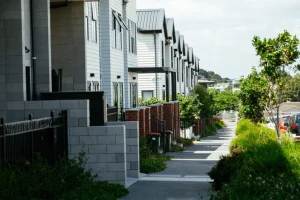
Terrace Housing and Apartment Buildings Zone

The Zone is a high-intensity zone enabling a greater high – intensity of residential development than previously provided for. This zone provides for urban residential living in a range of the forms of including terrace housing and apartments.

Within walkable catchments, as identified on the planning maps, development of at least six storeys is enabled. Outside the walkable catchments, buildings are enabled up to at least five storeys. In identified Height Variation Control areas buildings of seven or more storeys are enabled. Permitted height standards vary depending on the scale of the adjoining centre, to achieve a transition in height from the centre to adjoining lower scale residential zones.

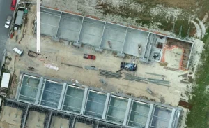
A notable change is that resource consent was previously required for the construction of any building (even a single house) in this zone. Up to three houses complying with the Zone Standards are now permitted.


Qualifying matters

PC 78 has immediate effect provided all Zone Standards are being complied with. A number of sites have been identified as being subject to a “qualifying matter”. This includes sites subject to flooding, sensitive ecological areas, significant volcanic view shafts amongst others.

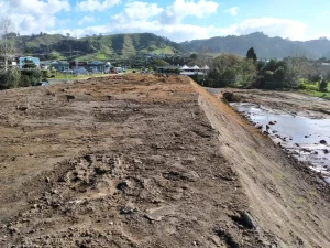
Other matters such as excessive earthworks that would previously have required resource consent, will continue to have this requirement.

For more detailed information on these changes, please contact RPC Land Surveyors.

Monitoring Surveys – Pre-loading

As part of the land development process, RPC Land Surveyors often work with Geotechnical Engineers to address various geotechnical issues that may be present on a site. An example of this is a monitoring survey RPC Land Surveyors are conducting at 52 Wilson Road, Waihi Beach, to determine the amount of pre-load settlement. The Preliminary Geotechnical Assessment Report for the site concluded that 270mm to 730mm of settlement could occur as a result of the construction of a proposed commercial building.

To address this, the area of concern has been pre-loaded with a mound of fill 3 metres high by 30 metres wide by 90 metres long to work as a temporary weight to compact the site over time. 11 steel rods were placed vertically in the mound to act as monitoring points while the land settles. Over the 4 months that RPC Land Surveyors have been surveying the rods to date, the site has settled by up to 120mm in some locations. When the Geotech Engineer is satisfied that the site has settled to an acceptable level, the pre-load mound will be removed, and the construction of the building can commence. The amount of settlement that is occurring on this site is proof that geotechnical investigations and measures are critical in ensuring that a site will be fit for purpose. Monitoring surveys are an important part of this process so that all parties can be informed as to what is occurring on site.

At RPC Land Surveyors, we specialise in monitoring surveys, site settlement surveys, and geotechnical support as part of the wider land development process across New Zealand. Our experienced surveyors work closely with Geotechnical Engineers to provide accurate data that ensures every site is stable and ready for construction. From pre-load monitoring to as-built surveys and construction set-out, our team delivers precise, reliable surveying solutions that help developers, engineers, and project managers make informed decisions and achieve successful project outcomes.

Pre-load mound

New Staff

RPC Land Surveyors has two new staff – one an ex Air NZ pilot who has prior experience with survey drone operation in Auckland and is familiar with all airspace restrictions when flying.

Our second new staff member comes from the University of Otago and has worked as a builder before his time at the University.

The combination of background experience positions from our new staff enables RPC Land Surveyors to offer a more comprehensive all-round service to our clients on building certification and subdivision projects.

1000 Words

A picture is still worth a 1000 words.

That is what we discovered with our recent survey for the latest commercial industrial unit titles out at The Lakes, Tauranga.

A survey with the drone while the tilt slab walls are still exposed greatly speeds up the unit title side of the development such that we are achieving titles at the same time or before the building Code Compliance Certificate has issued, meaning sale and purchase agreements can settle when the building is complete.